
File:Hurricane danny 2003.jpg

本预览的尺寸:600 × 600像素。 其他分辨率:240 × 240像素 | 480 × 480像素 | 768 × 768像素 | 1,024 × 1,024像素 | 2,048 × 2,048像素 | 3,400 × 3,400像素。
原始文件 (3,400 × 3,400像素,文件大小:1.44 MB,MIME类型:image/jpeg)
摘要
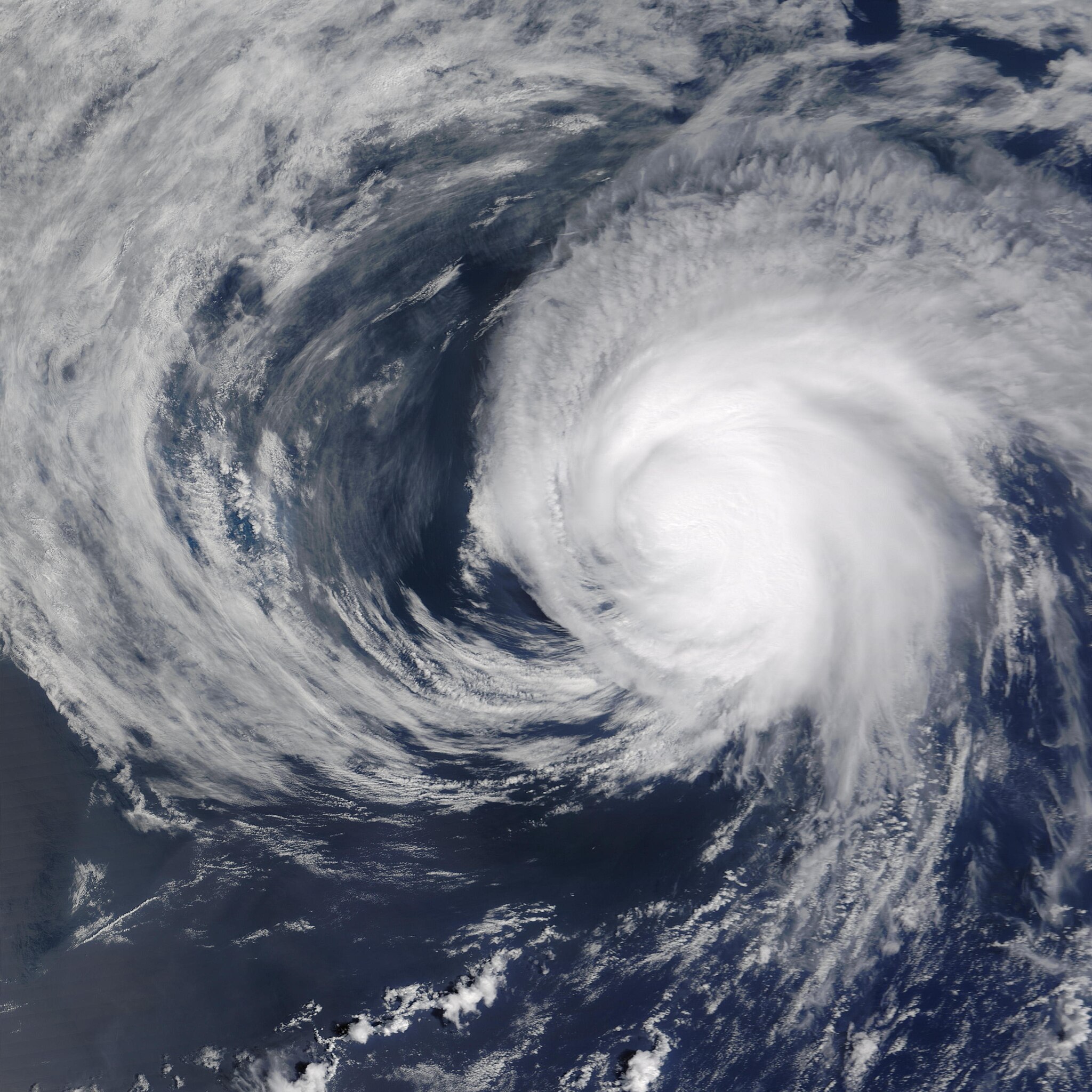
| 描述 | Although it sprawled across thousands of square kilometers in the Atlantic Ocean, Hurricane Danny never posed a threat to the United States East Coast, as it traced a circle in the Atlantic hundreds of miles off the Mid-Atlantic coast and dissipated over the span of just four days. Danny was a Category 1 Hurricane on July 19, 2003, 14:45 UTC, when this image was acquired by the Moderate Resolution Imaging Spectroradiometer (MODIS) on the Terra satellite. | |||||
| 日期 | ||||||
| 来源 | http://visibleearth.nasa.gov/view_rec.php?id=5528 | |||||
| 作者 | Jeff Schmaltz, MODIS Rapid Response Team, NASA/GSFC | |||||
| 授权 (二次使用本文件) |
|

文件历史
点击某个日期/时间查看对应时刻的文件。
| 日期/时间 | 缩略图 | 大小 | 用户 | 备注 | |
|---|---|---|---|---|---|
| 当前 | 2023年7月29日 (六) 10:05 | | 3,400 × 3,400(1.44 MB) | Nino Marakot | Reverted to version as of 22:19, 18 August 2006 (UTC) |
| 2023年7月29日 (六) 10:04 |  | 3,400 × 4,400(1.4 MB) | Nino Marakot | full size | |
| 2006年8月18日 (五) 22:19 |  | 3,400 × 3,400(1.44 MB) | Good kitty | == Summary == {{Information |Description=Although it sprawled across thousands of square kilometers in the Atlantic Ocean, Hurricane Danny never posed a threat to the United States East Coast, as it traced a circle in the Atlantic hundreds of miles off th |
文件用途
以下页面使用本文件:
全域文件用途
以下其他wiki使用此文件:
- de.wikipedia.org上的用途
- fr.wikipedia.org上的用途
- simple.wikipedia.org上的用途