
File:Map of Amr's Conquests.png
本预览的尺寸:800 × 506像素。 其他分辨率:320 × 202像素 | 640 × 404像素 | 1,024 × 647像素 | 1,280 × 809像素 | 2,560 × 1,618像素 | 7,025 × 4,439像素。
原始文件 (7,025 × 4,439像素,文件大小:75.62 MB,MIME类型:image/png)
摘要
| 描述 |
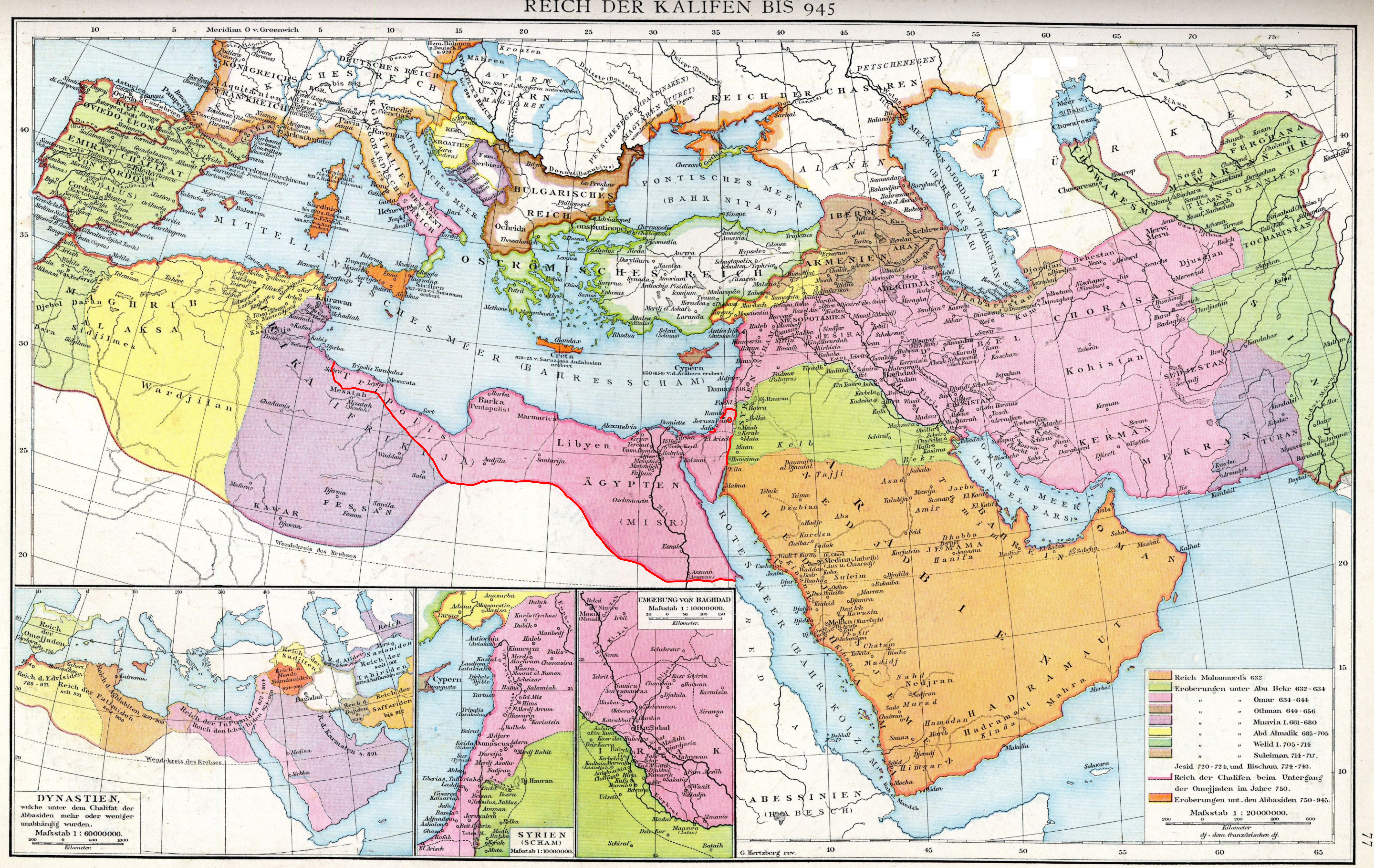
English: The empire of the Caliphs to 945. Map of the Historical Atlas of Gustav Droysen, 1886.
|
| 日期 | (Red-line edit done by uploader on 23 September 2019 |
| 来源 | Gustav Droysens Allgemeiner historischer Handatlas in 96 Karten mit erläuterndem Text Bielefeld [u.a.]: Velhagen & Klasing 1886, S. 77. |
| 作者 | Johann Gustav Droysen (6 July 1808 – 19 June 1884) |
许可协议
|
本作品在其来源国以及其他著作权期限是作者逝世后100年或以下的国家和地区属于公有领域。 | |
| 本文件已被确认为免除已知的著作权法限制(包括所有相关权利)。 | |
文件历史
点击某个日期/时间查看对应时刻的文件。
| 日期/时间 | 缩略图 | 大小 | 用户 | 备注 | |
|---|---|---|---|---|---|
| 当前 | 2019年9月23日 (一) 20:57 | | 7,025 × 4,439(75.62 MB) | Al Ameer son | User created page with UploadWizard |
文件用途
以下页面使用本文件:
全域文件用途
以下其他wiki使用此文件:
- en.wikipedia.org上的用途