
File:Tropical Storm Debby TRMM Image (2006).jpg
原始文件 (1,024 × 1,024像素,文件大小:215 KB,MIME类型:image/jpeg)
摘要
| 描述 |
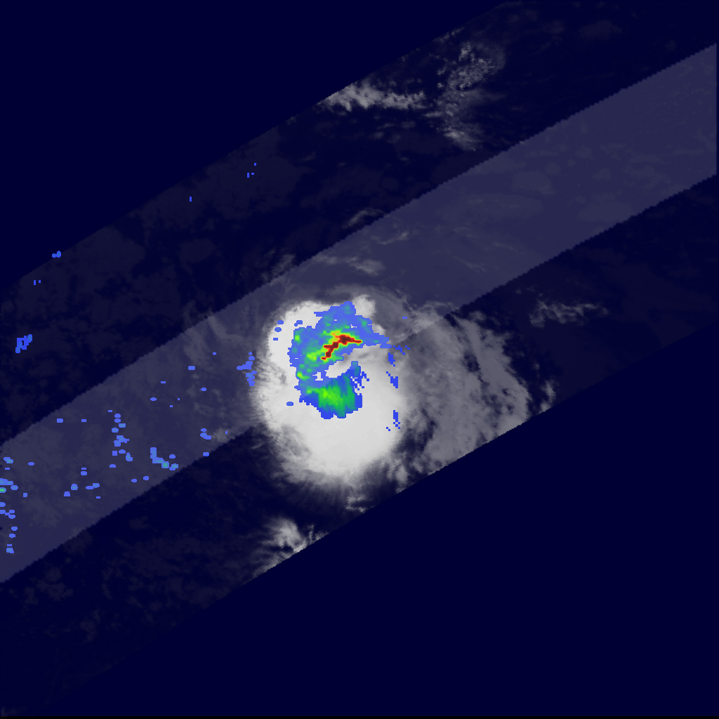
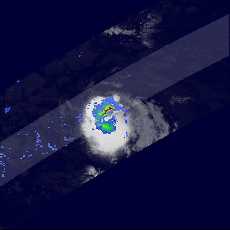
Compared to last year’s onslaught, the 2006 Atlantic hurricane season has so far been relatively uneventful, with no storm having reached hurricane strength as of mid-August. However, late August is when the Atlantic hurricane season becomes most active. As of August 24, 2006, Tropical Storm Debby was making its way through the central Atlantic and posed no immediate threat to any land areas. Known as a Cape Verde storm because of its formation in the far eastern Atlantic near the Cape Verde Islands, Debby began as a tropical depression on August 21, 2006, from an African easterly wave that moved off the coast of west Africa. This image was taken by the Tropical Rainfall Measuring Mission (TRMM) satellite on August 24, 2006, at 02:07 a.m. UTC (August 23 at 10:07 p.m. EDT) as Debby was moving northwest through the central Atlantic. TRMM reveals that Debby was a small, compact storm; however, a band of intense rain (dark red area) is apparent north of the center and indicates an area of active convection (uprising air). The TRMM satellite was placed into service in November 1997. From its low-earth orbit, TRMM provides valuable images and information on storm systems around the tropics using a combination of passive microwave and active radar sensors, including the first precipitation radar in space. TRMM is a joint mission between NASA and the Japanese Aerospace Exploration Agency. |
|||||
| 日期 | August 24, 2006 | |||||
| 来源 | http://earthobservatory.nasa.gov/NaturalHazards/Archive/Aug2006/debby_trmm_2006236_lrg.jpg | |||||
| 作者 | NASA satellite image created by the Earth Observatory, using data obtained courtesy of the Tropical Rainfall Measuring Mission (TRMM). | |||||
| 授权 (二次使用本文件) |
|

.jpg?uselang=zh)
.jpg?uselang=zh)
.jpg?action=history&uselang=zh)
.jpg)
文件历史
点击某个日期/时间查看对应时刻的文件。
| 日期/时间 | 缩略图 | 大小 | 用户 | 备注 | |
|---|---|---|---|---|---|
| 当前 | 2006年11月4日 (六) 07:29 | | 1,024 × 1,024(215 KB) | A7x | Compared to last year’s onslaught, the 2006 Atlantic hurricane season has so far been relatively uneventful, with no storm having reached hurricane strength as of mid-August. However, late August is when the Atlantic hurricane season becomes most active |
文件用途
以下页面使用本文件:
.jpg)